Technical description, servitude
Describe parcels of land
For various reasons, you may need to describe a parcel (s) of land in order to unambiguously designate them in a formal document such as a servitude deed or a particular legal or administrative request.
Concrete examples are, for example:
- define the portion of land required for a right of way, drainage, infrastructure or other;
- change or define an administrative boundary of municipality, agricultural zoning or other;
- define a portion of land to recognize rights acquired by ten-year acquisitive prescription;
- define portions of land for an agreement prior to a real estate transaction.
Our work will consist essentially in mathematically describing a portion of the land area in an unequivocal manner:
it is therefore to answer the question: what portion of which cadastral lot is affected / concerned? so that no one doubts the extent or location of this land.
As the territory to be described generally has a strong link with physical elements on the ground (such as a road, utility poles or property lines) the work normally requires field surveys to locate these elements beforehand.
The difference with the cadastral subdivision
Although the operation is similar, we must distinguish our subdivision and technical description services:
The subdivision concerns a project of parcelling out land to create new ones (or merge them) as well as assign them a new cadastral lot number. Everything is done in compliance with applicable municipal regulations (minimum frontage and surface area, setbacks for construction to be planned, etc.) and the standards for updating the cadastre of the responsible Ministry.
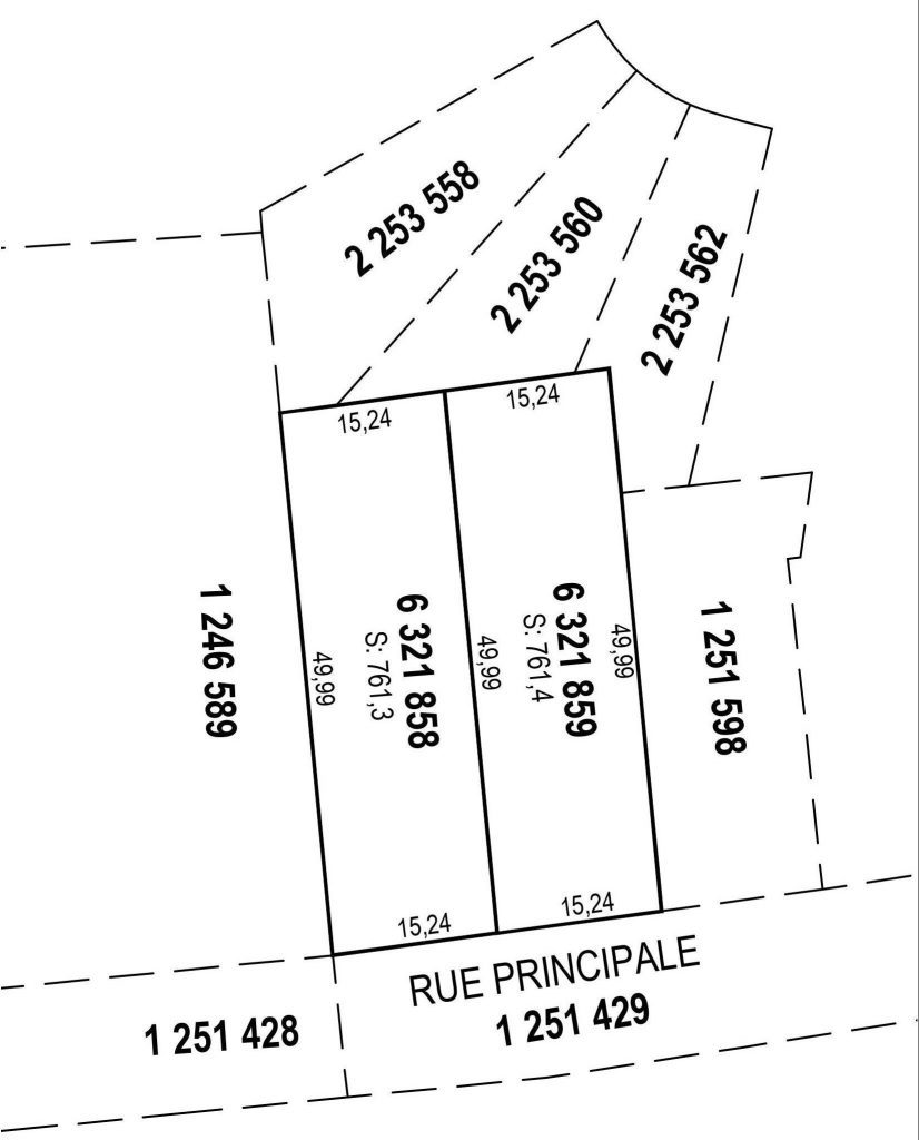
The technical description, for its part, normally relates to an area comprising several whole lots from the cadastre or even portions / fractions of whole lots and does not generally have any link with subdivision regulations.
What is included?
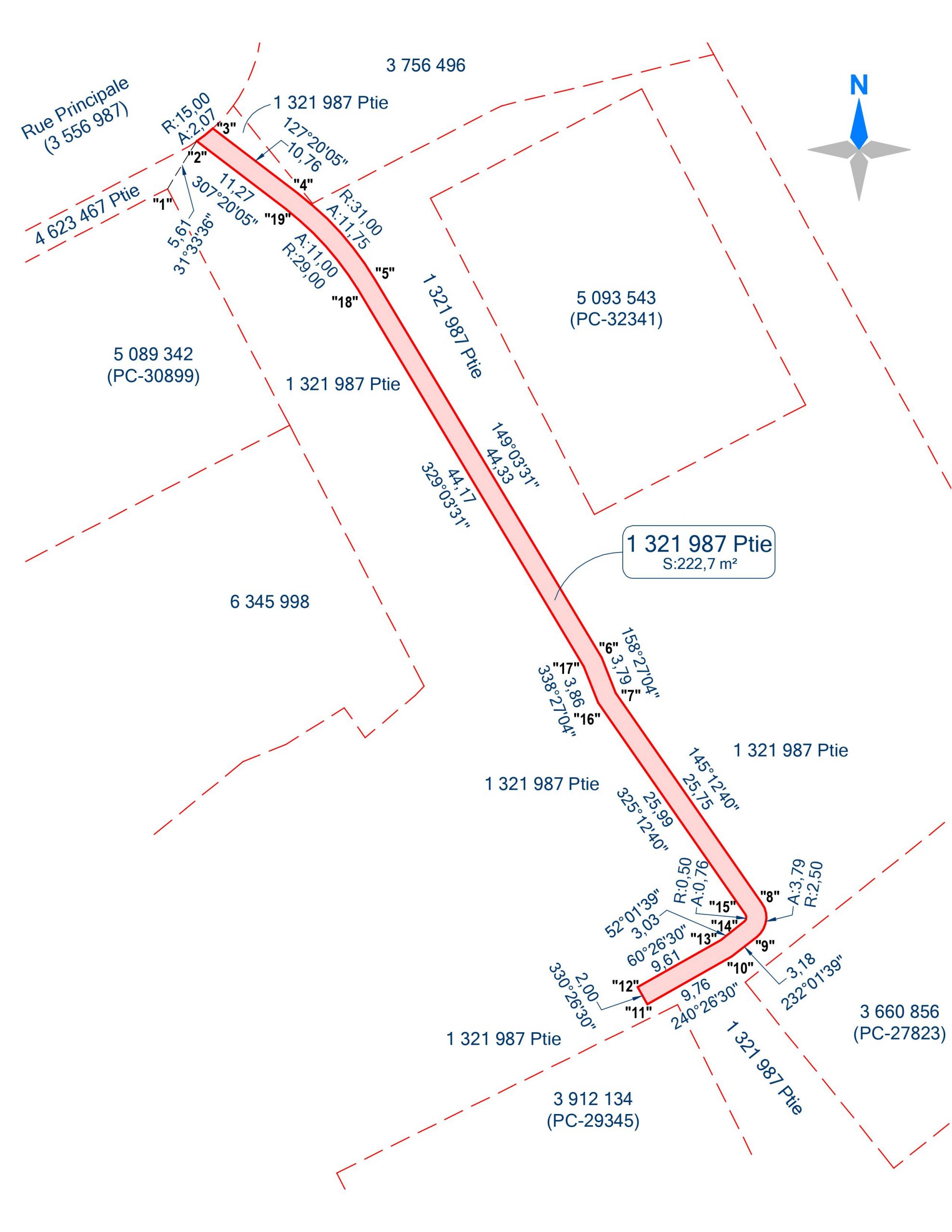
The technical description includes a plan and a report where each segment (straight lines and curves) forming the perimeter of the parcel of land is mathematically described by its horizontal length and its orientation.
There is also all the information required to correctly locate the parcel in an unequivocal manner, that is to say by mentioning the numbers of bounding lots and a connection to an existing lot corner in order to avoid an effect of sliding when required.
Finally, for each parcel, we also enter the calculated area and generally assign them an arbitrary number for subsequent reference.